Introducing Trimble TerraFlex 2024.20: Local Project workflow for field asset capture and inspection
We are excited to announce the release of Trimble® TerraFlex™ software v2024.20 and Trimble Terra Office™ software v2024.20.
This release brings powerful new features to streamline your field asset capture and inspection workflows. One of the standout features in this release is the Local Project workflow, designed to enhance efficiency and flexibility for users who need to capture and share field data directly from the field.
What is the Local Project workflow?
The Local Project workflow will sit alongside the existing Cloud workflow supported in TerraFlex. In the Cloud workflow, data captured in TerraFlex is automatically synchronized to the Trimble Connect® Map Viewer web application. Cloud-based data synchronization streamlines the process of deploying data collection projects to distributed field crews, and gets captured data back from those crews into a common location where it can be reviewed and exported.
The Local Project workflow allows users to create, capture, utilize and share field data without the need for cloud data synchronization. Data collection projects are created in TerraFlex, captured data is stored on the device and the user can then share or export that data using common geospatial formats.
Key benefits of the Local Project workflow
The Local Project workflow can be beneficial for smaller organizations where the same person handles both field data capture and deliverable creation, and they need to share completed fieldwork with clients or within their organization directly from the field. Using Local Projects is intuitive and straightforward, ensuring even users with minimal technical expertise can efficiently manage their projects.
For organizations with strict cloud security policies, the Local Project workflow enables the use of TerraFlex without field data synchronizing through a Trimble cloud environment. This gives users and their organizations full control over how data is moved from the office to the field and back again.
How to set up a Local Project
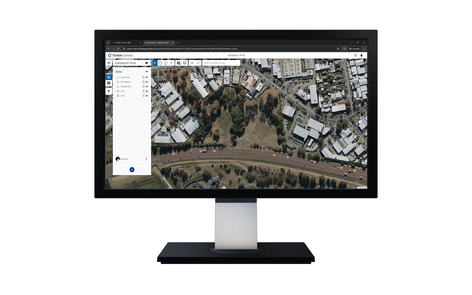
1. Create a field data collection project in Trimble Connect Map Viewer
The Local Project workflow begins in the Trimble Connect Map Viewer, where users can build and define data collection projects including form templates, coordinate system settings, and GNSS configuration settings. Projects are saved in the Trimble Connect Map Viewer, and can be edited or updated in the future if project requirements change.

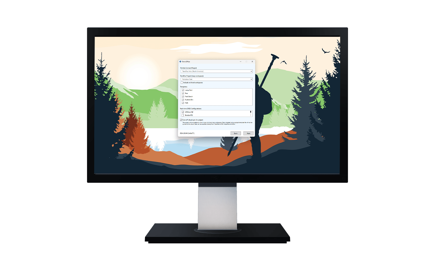
2. Download a data collection project using Terra Office
This release introduces a new Terra Office application that is used to create a Local Project template file from a project created in Trimble Connect Map Viewer. The template file includes all the form templates, coordinate system files, and GNSS configuration settings required to enable accurate field data collection in TerraFlex. The Local Project template file can be transferred to field devices using any approved mechanism: file sharing services, email or even USB file transfer.

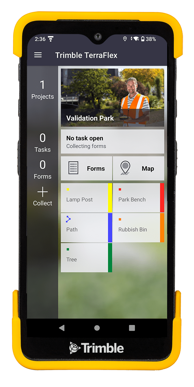
3. Create, capture and share from TerraFlex
Once the Local Project template file has been created in Terra Office, it can now be used to create new data collection projects in TerraFlex. When field work is complete, captured data can be exported to Shapefile or CSV straight from the device. Data can also be exported to a TerraFlex forms file and loaded into Terra Office, which supports a wider range of export formats like Esri® file geodatabase or CAD formats like DXF or DWG.

Availability
The Local Project workflow in TerraFlex v2024.20 is available to download from the Google Play Store now. Terra Office v2024.20 is available to download here.
To learn more, visit the product pages: Trimble TerraFlex and Trimble Terra Office, or contact your local authorized Trimble Distributor.